


The tropical depression located east of the Philippines intensified into Typhoon Trami. The storm is predicted to enter the East Sea in the coming days.
According to the Japan Meteorological Agency, on October 21, the tropical depression developed into Typhoon Trami. The National Center for Hydro-Meteorological Forecasting expects the storm to track mainly in a west-northwest direction.
By 4:00 p.m. on October 22, the typhoon’s center is forecasted to be over the sea east of the Philippines. Winds near the storm’s center are expected to reach level 8 (62-75 km/h), with gusts up to level 11. Sea waves in the area could rise between 3 to 4 meters.
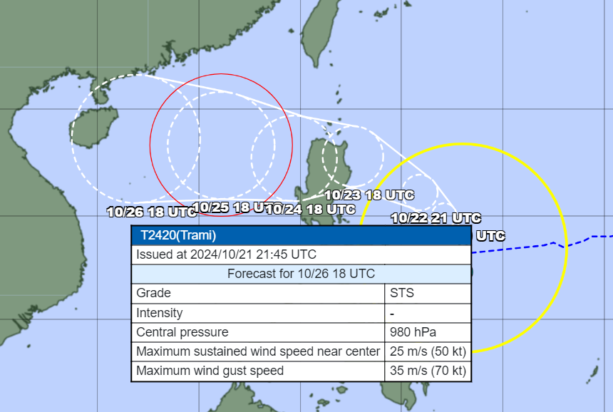
The meteorological agency predicts that Typhoon Trami may enter the East Sea around October 25. Starting in the afternoon and evening of October 24, the eastern sea area of the northern East Sea (east of 118.5 degrees East longitude) is expected to experience increasing winds up to level 8, reaching level 9-10 near the storm’s center, with gusts up to level 12. The sea conditions will be extremely rough, with waves between 3 to 5 meters and thunderstorms, accompanied by dangerous whirlwinds.


